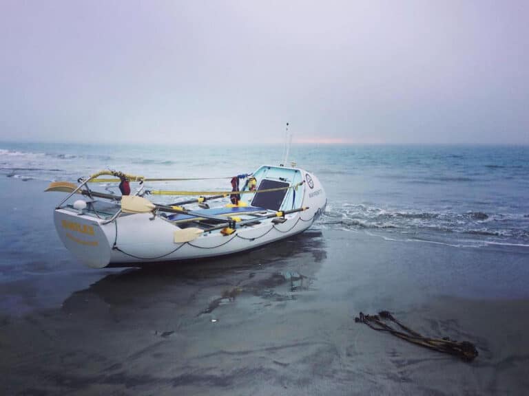
There is no 911 at sea. The premise that boaters must be self-reliant has guided emergency preparedness at sea for millennia. But now a device not much bigger than a cell phone provides a worldwide satellite link that, within moments of activation, summons help, indicates its exact position and gives rescuers information about the vessel in distress, which is then relayed to a network of military ships, aircraft and merchant vessels ready to respond anywhere on the planet. Welcome to the age of 911 at sea. Not all emergency position-indicating radio beacons or personal locator beacons are equal, though. Here’s a close look at the options and what they mean in terms of rescue time and additional preparations.
With rare exception very near the north or south pole, when an EPIRB or PLB is activated, the signal is instantaneously picked up by satellites hovering above the earth and routed electronically to the appropriate rescue authority — the U.S. Air Force if over land or the U.S. Coast Guard over water — and then to a rescue coordination center in the region of the rescue. (Both the USCG and foreign rescue authorities receive this information when in foreign waters.) From there, the staff of that RCC attempts to verify the signal is intentional — 96 percent are false alarms.
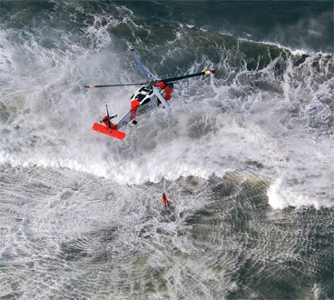
“The minute we determine it’s a distress, we’re going right away,” says Lt. Cmdr. Mark Turner, a U.S. Coast Guard pilot and now a Coast Guard spokesman regarding search and rescue. Turner says the first place they look is the “additional data” section of the EPIRB registration, which boat owners can update online at will (beaconregistration.noaa.gov). If the float plan seems to corroborate the EPIRB signal, Coast Guard assets are dispatched immediately. If registration comments aren’t helpful, they call emergency contacts listed on the vessel’s EPIRB registration. “We’re going to fully investigate, but we’re not going to spend hours,” Turner says. In fact, the Coast Guard will delay up to 30 minutes, but no longer, accounting for the $4 million spent responding to false alarms each year just in aircraft fuel and maintenance. (If half an hour doesn’t seem long, stand in an ice-cold shower for 30 minutes — and then go update that EPIRB registration.) Once the RCC gives the mission to a Coast Guard crew, it takes another 10 to 30 minutes to get an aircraft or boat headed toward the signal, plus flight time at 140 knots for a helicopter.
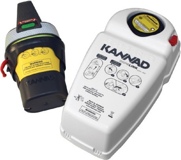
EPIRB Versus PLB
As far as rescuers are concerned, there is little difference between a pocket-size PLB and a larger EPIRB. Determining which is best comes down to how equipment pros and cons match intended use. “The best beacon to have is the one you have with you when you need it,” says Chris Wahler, marketing manager for ACR Electronics (acrelectronics.com). “Having one on your person is much better than one still on the boat if you somehow get separated.” It’s hard to beat the peace of mind of a PLB tucked into a front pocket, particularly for those who boat alone or those aboard a small boat that might capsize. PLBs are also small enough to pack a spare inside a life raft and are perfect for ditch bags.
But that pocket-size convenience comes at one important price. EPIRB antennas are designed to work best when the beacon is floating in the water. PLBs are waterproof and many float, but they transmit well only when kept above the water. “With a PLB, if that antenna is in the water, that’s where the signal is going to go,” Wahler says. “An EPIRB is autonomous. It floats in the best transmit position. You have to think about how you’ll use a PLB in advance. Treading water with one hand holding up that beacon is going to be difficult after a while.”
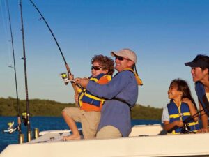
Most PLBs include some sort of life jacket mounting provisions, but this assumes an able-bodied castaway. PLBs also have to be manually activated while all EPIRBs sold in the past two decades transmit automatically when out of their bracket and wet. EPIRBs also have double the battery life — minimum 48 hours in the harshest conceivable conditions. A PLB’s 24-hour battery should be plenty, unless weather prevents immediate rescue. All EPIRBs also include a strobe light to help assemble scattered castaways and increase visibility to rescuers. A few PLBs recently began to include LED strobes, which aren’t quite as bright as an EPIRB’s incandescent strobe light.
Self-Contained GPS
The biggest difference in rescue time among beacon choices comes down to $100 — the typical price increase for adding GPS into an EPIRB or PLB. Without GPS, polar-orbiting satellites compute an EPIRB’s position as they pass overhead, but this often takes 90 minutes and could exceed three hours, and that position is only accurate within about two miles. With GPS EPIRBs, the beacon broadcasts its position through geostationary satellites to the RCC every 50 seconds, accurate within 100 yards.
Turner points out that Coast Guard aircraft can now hone in on the 406 MHz signal of either type of beacon. “But we can also decode the GPS position [from an EPIRB or PLB] right in the cockpit,” he says. This provides pilots not just a heading to fly but also a waypoint and exact time of arrival. Those coordinates can also be read from airplanes over 100 miles away and relayed to closer rescue assets. “A GPS-equipped EPIRB takes a lot of the search out of search and rescue,” Turner says. “That and [an updated EPIRB] registration are the two best ways to ensure the quickest possible rescue.”
Automatically Deployed
While there are only two major choices for EPIRBs — with or without built-in GPS — there are also two choices for mounting brackets. All EPIRBs activate when out of their brackets and wet. A Category I bracket houses the EPIRB in a protective shell designed to eject the beacon if the boat sinks. A Category II bracket simply stores the beacon and prevents accidental activation. While safety seems to favor the beacon automatically deployed from a Category I bracket, keep in mind that a beacon mounted near the helm where it’s easy to grab is less likely to burn in a fire or be swept away in rough seas. Also realize that many outboard-powered boats contain enough floatation that they’ll capsize but never sink the 13 feet required to trip the pressure-sensitive release on Category I brackets.

Who Will Show Up?
A third of U.S. Coast Guard helicopters can reach about 300 miles off the coast — farther if they can refuel mid-ocean — while the remainder of the fleet can respond up to 170 miles offshore. If the helicopter responding was already airborne on a law-enforcement mission, they may not have a rescue swimmer aboard. Coast Guard cutters are also stationed far offshore. Coast Guard airplanes can reach 1,000 miles from any major airstrip, worldwide. They’re likely to be first on scene far offshore. They can drop handheld radios, safety equipment, water and provisions, dewatering pumps and life rafts.
Air National Guard helicopters refuel in midair in settled weather, greatly extending their range, and U.S. Navy assets are available to the rescue coordination center as well. Foreign rescue craft respond in foreign waters. Beyond 300 miles from the U.S. coast, rescue may be from a merchant ship. The Amver system monitors more than 21,000 ships from 140 nations — 40 percent of the world’s merchant fleet. On average, 3,900 participating ships are at sea at any given moment, eager to respond to any high-seas emergency. An Amver ship may respond even when close to shore if the RCC deems it the best and closest resource.
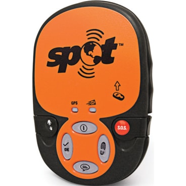
Spot Versus PLB
Spot — It’s smaller than a PLB and adds limited one-way communication and GPS tracking with user-replaceable AA lithium batteries. Coverage is limited to most major landmasses and adjacent offshore waters (though not mid-ocean), except for India and eastern Africa. Spot boasts very good (but not 100 percent) likelihood of each message being sent. GPS positions are more accurate than those from a PLB but are updated only every five minutes, and Coast Guard aircraft can’t use that signal, even for homing. Spot may take 15 minutes for the first GPS fix.
» Price: $100 for a basic device plus $100 per year. Add $50 per year for tracking plus other subscription services.
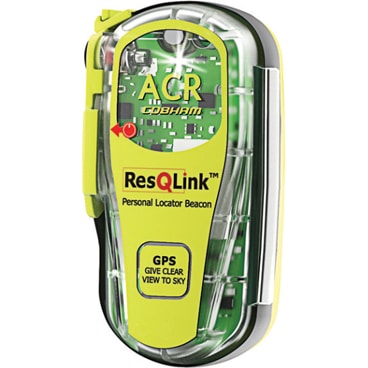
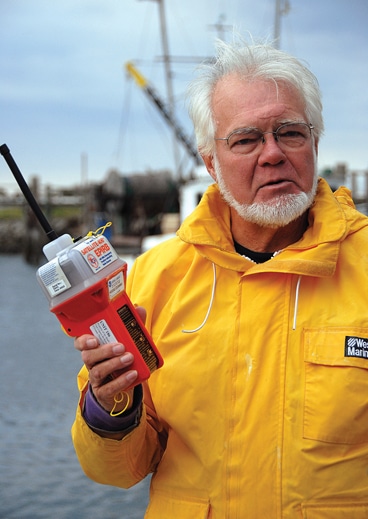
PLB — It’s built to robust government specifications and is USCG monitored. It comes as close to a guarantee of rescue as any device allows. The first GPS fix comes less than a minute from first activation and is updated every 50 seconds. ACR offers a subscription-based “I’m OK” e-mail or text message, triggered by each PLB test (406link.com), but it’s limited to about one per month for battery conservation. A PLB GPS test also includes coordinates but wastes far more battery power.
» Price: About $300 (with GPS) and $100 every five or six years for a new battery as well as a test of electronics and watertight seal.
What About Spot?
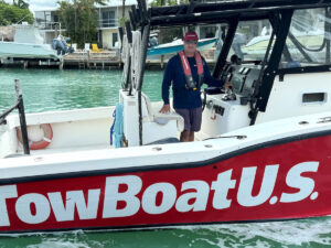
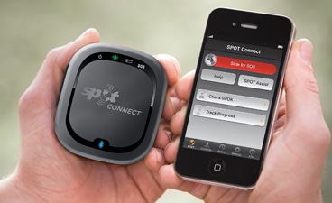
Spot offers one-way satellite messaging through private Globalstar satellites (findmespot.com). Messages are written and addressed online, before heading offshore, to multiple e-mail or text message recipients. When activated, the Spot device simply sends those messages along with its current GPS position. Most Spot devices include four buttons. The “SOS” button alerts Geos (geosalliance.com), a private company that initially fills the role of the U.S. Coast Guard’s rescue coordination center to determine distress validity based on information in the Spot registration form. Geos then contacts the Coast Guard or appropriate rescue organization — including private rescue resources in countries where government rescue might not be ideal — and provides that agency with continuous position updates, registration information and any other assistance needed. The “help” button can be programmed to contact roadside assistance and TowBoatU.S. or e-mail and text trusted friends. The “OK” button sends a different message to a separate list of 10 contacts, and the “track” button drops a GPS position onto a Google Map every 10 minutes, available online for instant or future viewing. Spot can update Facebook and Twitter accounts. Some devices include a fifth button that sends yet another preset message, and the new Spot Connect pairs with a smartphone to allow 41-character type and text one-way messaging and social media updates.
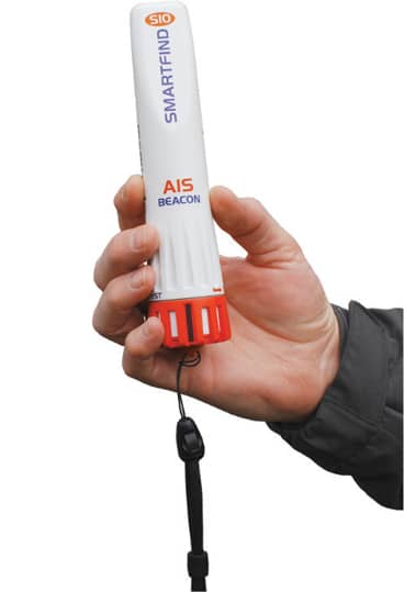
Handheld AIS Rescue Beacons
The worldwide Automatic Identification System broadcasts information about a ship or boat — vessel name, position, speed and heading — over VHF radio frequencies. Nearby AIS-equipped vessels display this information right on their plotter screens. New in 2010, handheld AIS rescue beacons broadcast a unique distress signal along with their GPS coordinates. Any AIS-equipped vessel within about 10 miles will see the signal and respond immediately. AIS systems are required on most commercial vessels and are increasingly common on yachts. Look for this feature to be built into EPIRBs and PLBs within the next three years.
The U.S. Coast Guard is asking all boat owners and operators to help reduce fatalities, injuries, property damage, and associated healthcare costs related to recreational boating accidents by taking personal responsibility for their own safety and the safety of their passengers. Essential steps include: wearing a life jacket at all times and requiring passengers to do the same; never boating under the influence (BUI); successfully completing a boating safety course; and getting a Vessel Safety Check (VSC) annually from local U.S. Coast Guard Auxiliary, United States Power Squadrons(r), or your state boating agency’s Vessel Examiners. The U.S. Coast Guard reminds all boaters to “Boat Responsibly!” For more tips on boating safety, visit www.uscgboating.org.